This page contains the list of images of the Kuril Islands: Kunashir,
Atlasov and Paramushir (Russian Far East):
volcanoes, mountains and natural landscapes.
Clicking on the preview in the list below you will be transferred to the page with the
full sized image
(usually 1024 x 768 pixels and approximately 150 kilobytes).
Russia - Asia
KURIL ISLANDS (KURIL ARCHIPELAGO)
(Kunashir, Atlasov and Paramushir Islands in the Pacific Ocean)
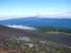
Top of the Alaid volcano cone. Height - 2339 meters above sea level.
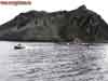
Atlasov Island
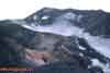
Ancient caldera - the basement of the old Alaid volcano and a
new Alaid volcano slope covered by scoria sediments (pyroclastic material).
Altitude - 1050 meters above sea level. Atlasov Island
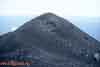
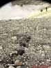
One of the 33 side (collateral) craters of Alaid volcano.
Atlasov Island
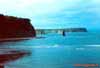
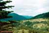
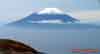
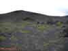
Alaid volcano on the Atlasov Island (height - 2339 meters above sea level).
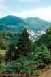
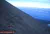
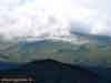
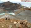
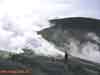
View from the Ebeko volcano top on the Paramushir Island
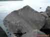
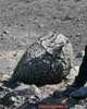
Lava block from the Taketomi volcano eruption. Atlasov Island
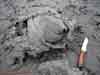
Volcanic bomb from the Taketomi volcano eruption. Atlasov Island
Volcanic scoria crater plug (stopper). Taketomi volcano at Atlasov Island
Taketomi volcano - it is a side (collateral) crater of the Alaid volcano.
The cone is composed from the porous eruption sediments, coherent with lava
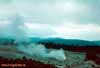
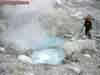
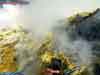
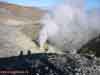
Steam-to-gas streams spurted from the fumarole field "Iyulskoye" (July).
Ebeko volcano, Paramushir Island
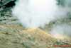
Volcanic boiling copper. North-East fumarole field of the Ebeko volcano.
Paramushir Island
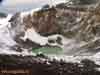
Active funnel of the Ebeko volcano Northern crater
with hyeracid thermal lake. Paramushir Island
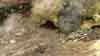
One of the thermal stream "Lagerniy" (Camping) sources on the eastern slope
of the Ebeko volcano. Paramushir Island
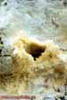
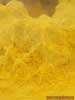
Fumarole sulfur of the Ebeko volcano. Paramushir Island
Volcanic bomb of the "crust of bread" type in the Ebeko volcano Northetn
crater.
Paramushir Island
View to the Middle and Northern craters of the Ebeko volcano from its top.
Paramushir Island
Fumarole field "Iyulskoye" (July). Gas temperature is 493 °С.
Paramushir Island
Fissure (crack) in the piroclastic sediments on the external slope of the
Ebeko volcano crater (3 meters deep). Paramushir Island
Fumarole "Uragannaya" (Hurricane). The speed of gas outflow is more than
30 meters per second. Paramushir Island
Plastic sulfur (hair type) produced by the "Pauk" (Spider) fumarole.
Paramushir Island
Plastic sulfur (hair, of spider net type) produced by the "Pauk" (Spider)
fumarole.
Paramushir Island
Strong steam-to-gas streams spurted from the fumarole field "Iyulskoye"
(July),
arised in 2005 on the external slope of the Ebeko volcano Northern crater.
Paramushir Island
Fumarole fields on the Ebeko volcano eastern slope.
Paramushir Island
"Lagerniy" (Camping) stream, collecting a few thermal streams flowing
from the eastern slope of Ebeko volcano. Paramushir Island
From Photo Nature section of our site you can also download thousands images of fungi, lichens, plants and animals, made by professional Russian field biologists and geographers during their expeditions all over the Russia and former USSR republics. All objects from our collection are determined by scientist and have exact scientific name, date and place of taking picture, as well as size of the original image.
You are able to find necessary pictures using four different approach:
1) with a help of Geographic Index (all objects are separated by countries and nature geographical zones), 2) with a help of Systematic Index (all objects are separated by their systematic position),
3) with a help of Alphabetical Index (all objects are separated by their scientific Latin names according to the alphabet), and
4) with a help of Search Form (you can search scientific (Latin) names of species, genus, family, or order).
Our Field Ecology Center published more than
180 methodical materials for nature studies. Some of them are in English: